
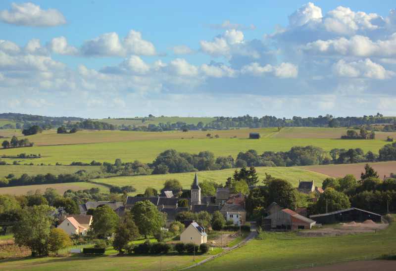
Au départ de l’ancienne gare de Thury-Harcourt, cet itinéraire balisé vous plongera au coeur de paysages très vallonnés en empruntant la route de la Suisse normande pour atteindre Culey-le-Patry, perchée sur un point haut. En descendant la vallée de Saint-Martin-de-Sallen, les vues lointaines s’étendent sur l’autre versant de la vallée de l’Orne. Voici une Suisse normande secrète aux paysages préservés. En chemin, les sites bucoliques des chapelles Saint-Bénin et Saint-Joseph sont propices à une pause nature.

- Distance 0 km
- Elevation gain 0 m
- Elevation lost 0 m
- Min. elevation 0 m
- Max. elevation. 0 m
- Duration (depending on pace) 02:00:00
Get all the routes on your smartphone with the Suisse Normande Outdoor app. You'll find a host of functions:
- Take advantage of detailed IGN maps
- Download data for consultation even when you're not connected to the network
- Geolocate yourself at any time on the route and altimeter profile
- Activate the off-track alarm to be alerted if you stray from the itinerary
- Find nearby services
- Share your experience (add a report, share your lap time)...


Falaise - Suisse Normande Tourist Office
+33(0)2 31 90 17 26
Tourist Office
send mail
Suisse Normande Tourisme
+33(0)2 31 79 70 45
Tourist Office
send mail
![]()
Montagnes de Normandie
+33(0)2 31 59 13 13
Tourist Office
send mail
Val d'Orne Tourist Office
+33(0)2 33 35 86 57
Tourist Office
send mail
 Suisse Normande Outdoor - Parcours - Vallées et panoramas de Suisse normande
Suisse Normande Outdoor - Parcours - Vallées et panoramas de Suisse normande
Suisse Normande Outdoor - Parcours - Vallées et panoramas de Suisse normande
Suisse Normande Outdoor - Parcours - Vallées et panoramas de Suisse normande
Suisse Normande Outdoor - Parcours - Vallées et panoramas de Suisse normande

