Panoramas de Suisse Normande
Add to my favorites

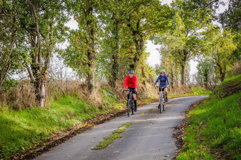
Au cœur d'une région vallonnée à la nature encore préservée, la variété des paysages d'un versant à l'autre offre un éventail complet des milieux naturels de la Suisse Normande.
La boucle est signalée dans les deux sens par la pastille rouge portant le numéro 25.
The characteristics of the route.

PONT-D'OUILLY (14)
- Distance 0 km
- Elevation gain 0 m
- Elevation lost 0 m
- Min. elevation 0 m
- Max. elevation. 0 m
- Duration (depending on pace) 02:00:00
- Suivre le balisage
Report a problem
All the routes on your smartphone
Download the Suisse Normande Outdoor mobile app
Get all the routes on your smartphone with the Suisse Normande Outdoor app. You'll find a host of functions:
- Take advantage of detailed IGN maps
- Download data for consultation even when you're not connected to the network
- Geolocate yourself at any time on the route and altimeter profile
- Activate the off-track alarm to be alerted if you stray from the itinerary
- Find nearby services
- Share your experience (add a report, share your lap time)...

stephan65
The 2025/08/14
En savoir plus
Ajouter votre chrono et partager vos sensations
2025/08/14 stephan65
Circuit très bien balisé. La plupart du temps sur de petites routes peu fréquentées et en général bien goudronnées. Attention quelques montées un peu raides. Belle descente vers la fin du parcours.
2025/08/14 stephan65
Circuit très bien balisé. La plupart du temps sur de petites routes peu fréquentées et en général bien goudronnées. Attention quelques montées un peu raides. Belle descente vers la fin du parcours.
Services nearby

Le Sablé d'Or
PONT-D'OUILLY
L'Epicerie du Coing
PONT-D'OUILLY

La Tribu des Cimes
LA POMMERAYE
Cave de la Loterie - Cidrerie de la Suisse-Normande
CLECY
Bergerie des Ber'Tommes
CLECY


Falaise - Suisse Normande Tourist Office
+33(0)2 31 90 17 26
Tourist Office
send mail
Suisse Normande Tourisme
+33(0)2 31 79 70 45
Tourist Office
send mail
![]()
Montagnes de Normandie
+33(0)2 31 59 13 13
Tourist Office
send mail
Val d'Orne Tourist Office
+33(0)2 33 35 86 57
Tourist Office
send mail
 Suisse Normande Outdoor - Parcours - Panoramas de Suisse Normande
Hello, world! This is a toast message.
Suisse Normande Outdoor - Parcours - Panoramas de Suisse Normande
Hello, world! This is a toast message.
Suisse Normande Outdoor - Parcours - Panoramas de Suisse Normande
Hello, world! This is a toast message.


OK
Annuler