
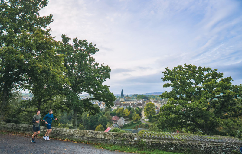
Ce circuit au départ de Thury-Harcourt vous emmènera par la voie verte de la Suisse Normande jusqu'aux pieds des Costils d'Aunes. Vous rejoindrez ensuite par Saint-Silly le belvédère de Thury-Harcourt et son panorama. Après un retour sur votre point de départ, vous repartirez vers le plan d'eau du traspy et sa vallée avant de rejoindre le village et son château. Un parcours avec peu de dénivelé, ouvert au plus grand nombre.

- Distance 8.34 km
- Elevation gain 155 m
- Elevation lost 155 m
- Min. elevation 23 m
- Max. elevation. 94 m
- Duration (depending on pace) 0h50 à 1h30
- Suivre le balisage

Get all the routes on your smartphone with the Suisse Normande Outdoor app. You'll find a host of functions:
- Take advantage of detailed IGN maps
- Download data for consultation even when you're not connected to the network
- Geolocate yourself at any time on the route and altimeter profile
- Activate the off-track alarm to be alerted if you stray from the itinerary
- Find nearby services
- Share your experience (add a report, share your lap time)...

Nico54
Nico54


Falaise - Suisse Normande Tourist Office
+33(0)2 31 90 17 26
Tourist Office
send mail
Suisse Normande Tourisme
+33(0)2 31 79 70 45
Tourist Office
send mail
![]()
Montagnes de Normandie
+33(0)2 31 59 13 13
Tourist Office
send mail
Val d'Orne Tourist Office
+33(0)2 33 35 86 57
Tourist Office
send mail
 Suisse Normande Outdoor - Parcours - 5 - La vallée du Traspy
Suisse Normande Outdoor - Parcours - 5 - La vallée du Traspy
Suisse Normande Outdoor - Parcours - 5 - La vallée du Traspy
Suisse Normande Outdoor - Parcours - 5 - La vallée du Traspy
Suisse Normande Outdoor - Parcours - 5 - La vallée du Traspy

